The Blue Country Gazette is the successor to the Rim Country Gazette, reflecting our evolution to a nationwide political blog for readers who identify as "blue," liberals, progressives, and/or Democrats. Our mission is to provide distinctive coverage of issues during a time of extreme polarization in the U.S. We strive to provide side-stories and back-stories that provide additional insights and perspectives conventional coverage often doesn't include.
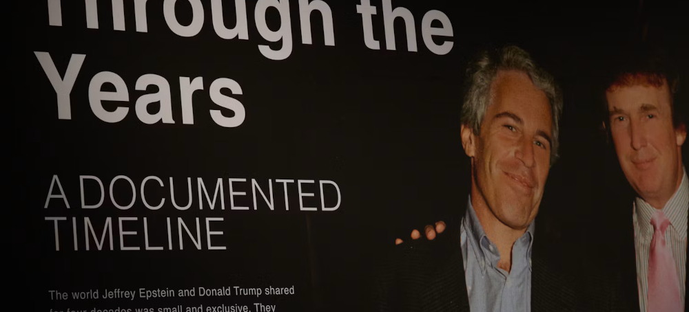
An exhibit on the Epstein files. (photo: Edna Leshowitz/Getty)
Donald Trump’s team helped craft the memo announcing there would be no further investigation.
Ellie Quinlan Houghtaling/The New Republic
The White House was involved in the FBI’s Epstein files cover-up all along.
The FBI’s July 2025 Epstein files memo immediately blew up in the bureau’s face. Its declaration that there was no “client list,” no punishable co-conspirators, and no grounds for further investigation both infuriated the president’s MAGA voter base and started the long domino effect that would eventually oust ex–Attorney General Pam Bondi.
Trump administration messages obtained by Raw Story revealed Friday that Taylor Budowich, then the White House deputy chief of staff, had his fingers in the FBI’s drafting process prior to the memo’s public release.
“Have something I can edit?” Budowich emailed FBI Director Kash Patel two weeks before the memo was released. The email’s subject line read: “Re: Draft memo from DOJ—we have not edited it yet.”
“Just got it from DOJ. Here you go. Thanks,” Patel responded hours later.
The next day, Budowich told Patel that he had passed the draft along to the White House communications team, noting that the message needed to be pasted on DOJ and FBI letterhead, according to Raw Story.
Almost a week later, then–Deputy Attorney General Todd Blanche sent a “final version” to Budowich. It failed to meet Budowich’s expectations, however, lacking the identifying seal of the Justice Department.
“I need a version on letterhead,” Budowich repeated. “Someone needs to own this. I can’t give a doc to a reporter that could easily be confused with a [high school] term paper, so need to provide some validation of the doc.”
Diego Pestana, Blanche’s counsel, fulfilled Budowich’s request an hour and a half later.
“These records show that Kash Patel worked hand in hand with the former White House deputy chief of staff on the 2025 DOJ-FBI memo, which stated there would be no further investigation or release of the Epstein files,” Chris Swartz, senior counsel and deputy director of ethics and anti-corruption at the Democracy Defenders Fund, told Raw Story.
“It’s deeply concerning that the FBI coordinated with the White House on this memo, given President Trump’s well-documented association with Jeffrey Epstein and Trump’s frequent mention in the files,” Swartz added.
BOYS AT PLAY: Trump and Epstein memorialized in bronze.
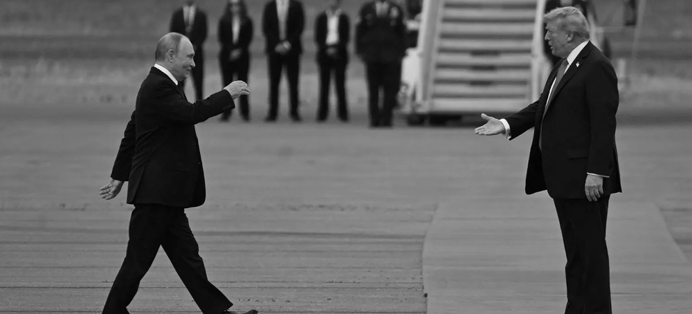
US President Donald Trump greets Russian President Vladimir Putin on the tarmac after they arrive at Joint Base Elmendorf-Richardson in Alaska. (photo: Andrew Caballero-Reynolds/AFP)
AI could spell the end of humanity … if the world’s nuclear powers don’t destroy it first
Matt Bai/Rolling Stone
23 October 26
It’s hard to feel good about the prospects for humanity when someone tells you there’s a 40 percent chance, more or less, that AI bots will kill us all before the Yankees can win another championship. Nonetheless, some experts in Washington find hope in the history of nuclear arms.
It’s easy to forget now that for a half century during the Cold War, Americans lived every day with odds of extinction that felt well above four in ten. But the worst did not come to pass, and policymakers are seizing on this as a model.
Most recently, Ro Khanna, a Silicon Valley congressman and Democratic presidential hopeful, has called for an international AI treaty with inspections among countries, modeled explicitly after the nuclear arms deals that kept Americans and Soviets from killing each other.
Even the most hopeful proponents of a Cold-War framework for AI will admit that the comparison is imperfect. After all, humans had control over nuclear arsenals; the missiles were never going to launch themselves. And for most of the 20th century, there was very little danger that some non-state terrorist group was going to build its own nuke — whereas every teenager in the world has access to Claude Code.
These trifling points aside, though, I worry about the Cold War analogy for an entirely different reason: it assumes that the threat from nuclear weapons is a bygone chapter in our history, successfully concluded. That strikes me as dangerously naive, because while everyone is suddenly fixated on what could happen when rogue agents hack into water supplies, the specter of nuclear confrontation has been quietly creeping back toward terrifying plausibility.
At the center of this gathering storm are what the war planners call “tactical nukes,” which are essentially scaled-down nuclear weapons, more powerful than the bombs that leveled Hiroshima and Nagasaki and yet unregulated by existing treaties. The theory behind a tactical nuke is that it can vaporize a military or infrastructure target without annihilating an entire country.
Vladimir Putin has repeatedly threatened to use such a weapon in Ukraine — a threat analysts have generally regarded as posturing. But you have to wonder how long Putin is willing to grind on to no foreseeable end, his own country targeted daily by drone strikes and his public turning against the war, if he thinks he has a weapon in his back pocket that can break the Ukrainians once and for all.
The thing that would normally make that implausible — and has to this point — is Russian fear of how the Americans might respond. But things are more complicated now that Donald Trump has created his own frustrating quagmire in the Middle East, from which he’s found no obvious means of escape.
At various times this year, Trump has issued vague and ominous warnings to Iran’s leaders about what he might do if they didn’t surrender, promising to bring them “back to the Stone Ages” and that “an entire civilization will disappear.” (Hard to believe the Nobel Committee keeps snubbing him for the peace prize.) Trump recently told Newsmax that he wasn’t referring to nukes — just a really, really big bomb — and has no intention of using them in Iran. But you know, Trump says a lot of things, and a lot of them turn out to be unreliable.
It’s clear, too, that Trump doesn’t really care what happens to Ukraine or what it means for Europe; if he did, he wouldn’t have broken with NATO countries again this month by agreeing to buy billions of dollars worth of Russian diesel fuel. So you couldn’t really blame the Russians if they thought that Trump would abide a nuclear strike in Ukraine, especially if it gave him a good excuse to do whatever he wanted in Iran. History has turned on flimsier assumptions.
And while the Cold War powers openly flirt with nuclear strikes, the world order that once acted as a breaker is fast deteriorating, leaving chaos in its wake.
The war in Iran has already ignited regional clashes in Lebanon, Yemen, and Saudi Arabia. Russian sabotage in Europe has NATO countries fortifying their borders. China eyes Taiwan, India moves against its Muslims. Multilateral alliances are breaking down everywhere.
It all has the feel of pre-World War I entropy, one spark away from total conflagration — the difference this time being that several potential combatants have nuclear arsenals, and the two declining empires who used to police those weapons have instead devised a more elegant way to use them.
Experts I’ve talked to in the past few months are divided on whether it’s alarmist or reasonable to worry about a resurgent nuclear threat. One told me Putin would never risk the incurring the wrath of the Chinese, who are dead set against the use of tactical nukes. Another posited that Trump might be the first to strike if he thought he could get away with it. On one thing, at least, the experts who have war-gamed these scenarios seem to agree: if either country uses a tactical nuke, the chance that things escalates from there is a good bit higher than 40 percent.
STRANGE AS IT SOUNDS, the world’s record on nuclear arms stands out as one of the great success stories in human history. Never before has any technological leap in mass killing been used only once and then contained. And this despite the fact that it wasn’t just the two great powers in the world who possessed the technology to make a bomb, but several countries with less stable governments and considerably less to lose — Pakistan, North Korea, at one point even Libya.
At the dawn on the Cold War, it would have seemed almost preposterous to suggest that 70 more years could pass without a single nuclear detonation, even as two ideologies squared off for preeminence and dozens of ethnic conflicts raged in every part of the world. And yet here we are.
We had close calls, certainly. There was the Cuba Missile Crisis in 1963. Five years later, a NATO war-game exercise codenamed Able Archer confused the Soviets and very nearly triggered a nuclear response. India and Pakistan came perilously close to trading blows in 1999.
That such close calls were rare, and that none of them ended with a mushroom cloud, is a testament to remarkable statecraft all around — and especially in the United States, where policymakers came to understand early on that nuclear forces had to be deployed as deterrents to war rather than the means to win one.
A series of American presidents negotiated treaties with a hated foe, extracted commitments from the rest of the world, and navigated tense international crises without ever considering a nuclear first strike. Some took a more bellicose tone than others, and not all were very good presidents, but every one of them were serious men who did their part to further a legacy of restraint. Our survival was not an accident.
Then, of course, came Trump, who was asked, in a Republican debate in 2015, about the “nuclear triad” (air, land, and sea-based missiles) and looked as though the moderator were speaking Aramaic. “I think, for me, nuclear is just the power,” Trump sputtered. “The devastation is very important to me.”
In office, Trump has unraveled international treaties (including the last existing arms agreement with the Russians), hurled contempt at NATO allies, and waved away international law. He likes to say that his war in Iran is about keeping nuclear arms out of the ayatollahs’ hands, but that wasn’t the first rationale he offered or even the most persuasive. Trump’s only real foreign policy objective seems to be profit. His idea of statecraft is to wrangle a free plane and sell some crypto.
It’s not just Trump, sadly. Most of the politicians in Washington now are amateurs who seem profoundly less interested in history and policymaking than their Cold War predecessors. And this is what connects the potential crises of AI and nuclear war. (You can throw in climate change, too.)
At a moment where we face more existential perils at once than ever before, a generation of leaders plays around with TikTok and TMZ, focusing on specious conspiracy theories — Jeffrey Epstein’s death, the tyranny of vaccines — while the world spirals out of control.
You can imagine how a Bill Clinton, say, would have jumped at the chance to take on the complexities of AI and tactical nukes, cementing his legacy in the process. Trump’s vision of legacy is to tear down the Kennedy Center and raise up an arch.
We’re in a race against time now — the question is whether we can install a more serious-minded government, or if Congress and the Courts can manage to rein in the one we have, before humanity is overrun by AI bots or A-bombs or whatever else is headed our way. Technology alone won’t destroy us. Triviality just might.
With crazies like Stephen Miller guiding der Donald, the world is in great peril.
President's outright betrayal of Ukraine shows the U.S. is in a precarious position
Heather Digby Parton/Salon
20 October 26
America’s descent into chaos and depravity was foretold 10 years ago at a press conference. Donald Trump, who had just been nominated for president at the 2016 Republican National Convention, issued an invitation for one of America’s foes to hack the emails of Hillary Clinton, the former secretary of state and Democratic nominee for president.
Russia, if you’re listening, I hope you’re able to find the 30,000 emails that are missing,” he said. “I think you will probably be rewarded mightily by our press.”
The call came only days after emails from the Democratic National Committee were released following the hacking of the organization’s computer servers, which was widely assumed to have been perpetrated by Russian agents. As would become the habit over the following decade, many dismissed Trump’s remarks as mere trolling that weren’t intended to be taken seriously.
This was not the first time he had invoked Russia. Throughout the primary season, Trump had gushed in multiple interviews about Russian President Vladimir Putin and signaled his intentions to draw closer to Putin once in office. Trump even defended the dictator’s extra-judicial killings, blithely explaining, “Our country does plenty of killing.” But the press conference did mark the first time he enlisted Russia as his ally.
The overtures continued throughout Trump’s first term, most infamously when he sided with Putin during a bilateral meeting over America’s own intelligence agencies, which had found that Russia had interfered in the 2016 election. The president suggested an “election integrity” sharing operation between the two countries, a proposal that made it clear Putin had Trump wrapped around his little finger.
Then came Russia’s war of aggression against Ukraine. Throughout the 2024 election, Trump pledged to end the war in Ukraine within 24 hours of taking office — or of being elected. (His rhetoric often shifted.)
He apparently believed that he could get on the phone with Ukrainian President Volodymyr Zelenskyy and order him to immediately surrender or face his mighty wrath. Needless to say, this did not happen, and since then Trump has grown increasingly frustrated that he’s been shown to be nothing more than a paper tiger, a frustration that has now reached fever pitch due to his abject failure in the Iran war.
Desperate for a “win” — by which he means a Russian win — the president is now in the process of completely selling out Ukraine to his good friend Vlad.
In recent days, Trump has signed an executive order temporarily lifting the sanctions on Russian oil. While supposedly done to secure diesel fuel for the United States, which has seen prices skyrocket due to the president’s war of choice with Iran, the act is in practice a sign of goodwill toward Putin, America’s enemy, and will help him fund his war against Ukraine, our erstwhile ally.
A few days later, Trump waived several additional sanctions that a bipartisan congressional majority had passed just a few weeks ago at the behest of the late Sen. Lindsey Graham, R-S.C., who foolishly believed himself to have the president under his control.
Worse yet, in what will go down as one of the most appalling betrayals by a U.S. president in history, Trump and his good friend Elon Musk apparently sabotaged Ukrainian intelligence by slowing the Starlink and Starshield communications systems the country relies on for its defensive and offensive weapons systems.
Russia took swift advantage of the favor and unleashed one of the most massive bombardments of the war, killing civilians and hitting Ukraine’s energy sector. Trump also called for Zelenskyy’s ouster, and in an interview with Bloomberg published Sunday, the Ukrainian president accused Trump of pushing the country to surrender to Russia.
Trump has a number of apparent rationales for these moves. He wants to be seen before the midterms to be doing something about the price of gas and diesel. But that is a crisis of his own making due to his misbegotten war in Iran, for which he has no way out that will solve the problem. His ongoing war has altered the global energy markets in ways that are not easily fixed, which was the reason no president before him was stupid enough to attack Iran.
So now Trump is blaming Ukraine because it is bombing Russian oil refineries and demanding they stop so that Russia can sell its diesel — and finance its war, which led to the sanctions in the first place. Not to be overlooked is that Russia is a staunch ally of Iran and is helping them fight us, which Trump has waved off as having “nothing.” Some might argue that could constitute providing “aid and comfort” to America’s enemy.
Meanwhile, fingers are being pointed in multiple directions. Musk said the government is to blame for the Starlink/Starshield gambit. According to sources in the Pentagon, the order came from the White House. Trump claimed he doesn’t know anything about it. Secretary of State Marco Rubio shrugged that “it just sort of happened.”
Now, lest the Europeans get it in their heads that they should try to step up their own defenses by restricting Starlink in favor of a European-based system, the U.S. government is reportedly threatening them with “devastating” or “destructive” economic retaliation.
As a cherry on top of the administration’s full-on embrace of Russia, the Wall Street Journal reported that Putin has floated a summit with Trump and Chinese President Xi Jinping to decide Ukraine’s fate. (On Monday, Trump told reporters he was open to a meeting but denied it would focus on Ukraine, saying he wanted to discuss denuclearization.)
If Trump knew any history, he would know that such a meeting would prove to be his Yalta, the trilateral conference between President Franklin Roosevelt, British Prime Minister Winston Churchill and Soviet Premier Joseph Stalin that carved up Europe in the wake of World War II. The summit became widely seen by the right as “the sell-out at Yalta” because the Soviets ended up with Eastern Europe, but things have changed within the GOP.
The summit is clearly intended to elevate Russia back to superpower status, which it is not in any economic or military sense, and to demonstrate a new order in which Trump, Putin and Xi run the world. In reality, Putin and Xi now have the United States dancing to their tune, handing them power and influence to dominate their respective spheres.
The president’s flagrant betrayal of Ukraine is an outrage that has seemingly awakened some of the slumbering Republicans who know they are facing a drubbing at the polls in the quickly approaching midterm elections. Whether it will arouse the consciences of enough to truly step up and stop this breach of trust is unknown.
But the mere fact that Trump has gone this far to salve his ego, defy his critics by embracing Putin even more fervently and drum up a lame excuse for what may be the worst national security decision in American history leaves this country weaker, poorer and more distrusted around the world. It hardly seems possible, but we have reached yet another new low.
"The president suggested an “election integrity” sharing operation between the two countries, a proposal that made it clear Putin had Trump wrapped around his little finger."
People in President Donald Trump’s orbit have to be incredibly nervous about the Democrats retaking Congress and regaining the ability to investigate the vast swath of corruption that has been the hallmark of this administration.
Because of that, it was exceedingly tough to keep this list to just 10 of those people, so consider this a sampling of who will probably be facing an absolute grip of subpoenas.
And sure, Trump is likely going to try to pardon literally everyone on his way out the door, but that will only protect them from criminal consequences. It won’t do a damn thing to prevent Democrats from dragging them in front of Congress to lay all their malfeasance bare.
So without further ado, here are the top 10 people who will be most screwed in the event of a blue wave.
10. Curtis Wood
You might not know his name, but you know his work on the Reflecting Pool.
Somehow, even though he completely screwed up pretty much every part of that, his company got to keep the millions from its sweet no-bid contract. And then, as the cherry on top, it also got millions more to fix its own screw-ups.
It’s good to be Trump’s pool boy, apparently.
9. Todd Blanche
Attorney General Todd Blanche has thus far dodged any consequences for his wildly unethical behavior, even as 101 former federal and state judges filed a bar complaint against him.
Blanche has generally managed to avoid testifying under oath, and wouldn’t you if you were in his shoes? But that friendly little arrangement that allows him to lie with impunity will disappear on Jan. 3, 2026.
So enjoy your impunity while it lasts, Todd.
8. Lindsey Halligan
Oh, Lindsey. She’s very much gone, but very much not forgotten. You’d think since she had such a brief stay as interim U.S. attorney she might not make the top 10, but given that her entire tenure was extremely sketchy, here she is.
LIndsey HalliganAP
Halligan somehow managed to land indictments of both former FBI Director James Comey and New York Attorney General Letitia James after actual, factual career attorneys told the administration they wouldn’t—because there was no crime for which to indict.
But once a federal magistrate said that she made “fundamental misstatements of the law that could compromise the integrity of the grand jury process,” the jig was kind of up.
7. Tom Homan
Compared to a lot of people on this list, the border czar is a small fry. All Homan did was accept a $50,000 bribe in a brown paper bag. In the Trump administration, that’s basically pocket change.
But the real reason to haul Homan in front of Congress is to ask him who, exactly, made the investigation into that bribe go away, allowing him to join the administration in the first place.
Inquiring minds want to know!
6. Sean Duffy
Chat, is it good when the transportation secretary spends seven months on a family road trip sponsored by companies he regulates?
Duffy’s “Great American Road Trip,” which was so low-rent it only aired on YouTube, presented potential sponsors with an offer to “partner” with Duffy to advertise their wares during his sojourn.
What a delight it will be to hear from Sean about what sort of quid pro quo Toyota and Boeing got for sponsoring this thing.
5. Kristi Noem
Where do I even start?
Noem managed to pack so much corruption into her relatively brief stay atop the Department of Homeland Security that it’s hard to pick and choose. But Democrats should definitely—DEFINITELY—inquire about the $220 million she spent on ads where she rode around South Dakota on a horsey.
But how could Democrats resist also asking her about her flying loveshack with Corey Lewandowski or the hundreds of millions of dollars she showered on one of her donors on her last day?
4. Elon Musk
Musk is one of the most repugnant creatures to attach himself to this administration, and Democrats should go after him on two fronts.
Elon Musk wears a “DOGE” shirt.AP
First, there’s the carnage he created with the so-called Department of Government Efficiency. Musk should be made to answer for having his little minions storm the Social Security Administration, for dismantling the U.S. Agency for International Development, and so much more.
But it will also be an absolute delight to probe him on all of his sweetheart deals with the Trump administration—which he got as a “special government employee."
3. Jared Kushner
Somehow, Kushner has managed to keep a much lower profile during Trump’s second term, but that doesn’t mean that he isn’t making money moves.
Kushner is, inexplicably, one of our lead negotiators in the Middle East. And at the same time, his private-equity firm Affinity Partners is financed by … Middle Eastern countries like Saudi Arabia.
Can’t wait to hear his explanation to a House committee about how this was all totally fine.
2. Donald Trump Jr. and Eric Trump
Ah, the Trump sons.
If their daddy weren’t president, they would be relegated to owning a used-car dealership in upstate New York or working as slumlords in some seedy New York City buildings.
Instead, they’ve made so much money from no-bid federal contracts, just straight-up giveaways of your tax dollars. Besides their unique ability to fleece the U.S. taxpayer, the Trump fail-sons should also be made to answer for their participation in Trump’s crypto grift.
President Donald Trump and Russian president Vladimir Putin (photo: Brendan Lynch/Axios.)
Screws Ukraine by showering Moscow with one-sided concessions
Zachary Basu/Axios
16 October 26
President Trump is indulging his fondness for Vladimir Putin at a moment of acute political peril, forcing Republicans in the midterms to take cover as he showers Moscow with one-sided concessions.
Why it matters: With just three weeks until the election, Trump is rekindling a decade-long, scandal-scarred relationship with a dictator reviled by most Americans — including his own supporters.
Driving the news: Since speaking with Putin on Friday, Trump has embarked on a remarkable five-day campaign of diplomatic concessions and cover for Russia — sparking bipartisan blowback just as voters prepare to cast their ballots.
On Friday, Trump announced a deal to unleash millions of tons of Russian diesel onto global markets, easing sanctions designed to starve Moscow's war revenues.
On Sunday, Trump blindsided Zelensky by declaring an immediate "energy ceasefire." Russia has continued attacking Ukrainian energy infrastructure, with no apparent consequences from Washington.
On Tuesday, Trump doubled down on the diesel deal and brushed off concerns that the proceeds could finance Russia's war machine, even as GOP senators labeled it a "betrayal" and "a gift to our adversary."
Between the lines: The benefits to Russia are clear. Far less apparent is what Trump's concessions accomplish for American security, European allies or his own political fortunes.
For Europe: Washington is breaking ranks with a NATO alliance confronting a historic threat environment, as Russia escalates its hybrid campaign of sabotage, cyberattacks and drone incursions.
For Republicans: With control of Congress hanging in the balance, Trump is embracing a dictator viewed unfavorably by 81% of his own 2024 voters, according to a January YouGov poll.
The big picture: Trump's warm relationship with Putin has haunted his political career since 2016, when Russia interfered in the presidential election to help him defeat Hillary Clinton.
From the Mueller investigation to the Helsinki summit, Trump's deference toward Putin has long divided Republicans and put him at odds with his own national security establishment.
A decade of investigations, scandals and Washington outrage has done little to shake that affinity. If anything, the scrutiny appears to have hardened Trump's determination to defy the foreign-policy consensus.
What they're saying: On Monday, Trump again suggested that Russia was more interested in ending the war than the country it invaded, telling reporters: "I think, actually, Putin wants to make a deal more than Zelensky."
"The President's diesel deal will help lower prices for farmers, truckers, and families across the nation as he simultaneously urges both sides of the Russia-Ukraine conflict to stop strikes against refineries, which are driving up costs and hurting American consumers," White House spokesperson Anna Kelly said in a statement.
The bottom line: Losing control of Congress could paralyze Trump's legislative agenda and expose his administration to years of investigations and subpoenas.
But as polling alarms pile up, the president appears increasingly willing to follow his raw political instincts, regardless of the consequences for Republicans fighting to keep him in power.
In a Truth Social post Tuesday, Trump made clear that he sees himself as personally immune from the results of the midterms, writing: "I'm not running in the Elections, I've already won, IN A MASSIVE LANDSLIDE."
Ukraine had Russia on the ropes until Trump jumped into bed with Putin.
Trump’s allies are FURIOUS after a giant golden statue of a naked Trump went on display inside the European Parliament, and their reactions are absolutely priceless.
Donald Trump loves claiming that America is more respected around the world than ever. The European Parliament appears to have a rather different opinion.
An 8.5-foot sculpture titled “Orange Plague” has been installed at a busy intersection between two European Parliament buildings in Strasbourg, France. The gilded statue depicts a nude Trump covered in 23-carat gold leaf, holding the scales of justice in one hand and a long golf club in the other, with a golf ball representing the world.
He is sitting on the shoulders of a smaller, fully clothed man who appears to be struggling under his weight.
The message on the plinth reads:
“I am sitting on the back of a man. He is sinking under my burden. I will do anything to help him. Except stepping down from his back.”
Danish artist Jens Galschiot, who created the sculpture, said Trump represents a major threat to the rules-based international order, democratic values, and efforts to address the climate crisis. The work was inspired by “The Emperor’s New Clothes,” the famous tale about a vain ruler whose subjects are too afraid to tell him the truth.
Per Clausen, a left-wing Danish member of the European Parliament who invited Galschiot to exhibit the piece, said he isn't concerned about Trump's reaction.
“If someone is so thin-skinned that they cannot tolerate this sculpture being exhibited in the European Parliament, then they have no place on the world stage,” Clausen said.
The sculpture has appeared at other major events, including the COP30 climate summit in Brazil and the Munich Security Conference. Visitors in Strasbourg can even receive miniature versions, while the artist has made files available online for people with 3D printers.
And the contrast with Trump’s own taste in statues couldn't be more obvious.
Trump previously unveiled a flattering 15-foot golden statue of himself, “Don Colossus,” at his Miami golf course, depicting him fully clothed with his fist raised. He has also discussed plans for giant golden statues of himself at his presidential library in Miami.
So yes, Trump apparently has no problem with golden statues of Trump.
Just maybe not this one.
Trump's MAGA supporters, meanwhile, absolutely lost it.
One complained that the sculpture was a “disgrace” and accused Europeans of disrespecting the president of a friendly nation.
Another outrageously claimed that a naked Trump statue in Europe was somehow hypocritical and imagined the uproar if Trump displayed a naked Angela Merkel statue in the White House.
A third simply posted:
“I am ASHAMED of the European Parliament. You are disgusting.”
The White House has not publicly responded to the sculpture.
Given how quickly Trump usually lashes out when he feels mocked, that silence is certainly interesting.
What do you think? Is “Orange Plague” legitimate political satire, or did the artist go too far?
Trump's penchant for statues is inspiring less favorable monuments including this one celebrating his lifelong friendship with Jeffrey Epstein.
President Donald Trump is in a predicament. His party is headed toward potentially historic losses in the midterm elections, fueled largely by anger over his pro-inflation policies, including tariffs on allies, deportations of immigrant workers, and his misbegotten war against Iran.
And few things illustrate the damage better than soaring diesel prices, now averaging over $6.25 a gallon nationwide, according to AAA.
The data is clear on what’s driving those prices:
Russia struck first, destabilizing global energy markets with its misbegotten invasion of its neighbor Ukraine, and then that idiot Trump followed suit four years later with his own disastrous war against Iran.
The result has been a global energy crisis, with diesel shortages driving up the costs of everything from trucking and farming to manufacturing and food production. And voters are understandably furious.
Trump’s desperation is now clear, having finally punched through the things he truly cares about, like building arches and reflecting pools and cutting down hundreds of trees in defiance of court orders. He needs something, anything, to deflect blame for fuel prices before Election Day.
And so he concocted what he thought was a foolproof plan.
You see, he could openly shift American policy toward supporting his pal Vladimir Putin, the dictator of Russia, while pretending he was delivering lower fuel prices to American voters!
A residential building burns following a Russian air attack in Kharkiv, Ukraine, on Oct. 12.AP
And so, just weeks after signing the “Lindsey O. Graham Sanctioning Russia and Iran Act of 2026,” which the White House itself noted “authorizes and expands statutory sanctions, tariffs, and prohibitions on Russia and extends existing sanctions on Iran,” Trump went ahead and undermined the very purpose of that law.
He announced that he had negotiated a deal with Putin to supply Russian diesel to the American and global markets, with his administration temporarily lifting sanctions to make it happen.
And what a deal it was!
Russia would initially supply 300,000 metric tons of diesel, followed by another 500,000 tons in November, another million tons after that, and potentially another 3 million tons down the road.
Sounds like a lot, right?
That initial shipment amounts to roughly 14 hours of American diesel consumption. The first three shipments combined would cover about three and a half days. Even if every promised and conditional shipment materialized, the grand total would amount to less than 10 days of American consumption, not enough to affect global prices, not even at the margins.
And that’s assuming Russia had diesel to spare, which it doesn’t! In Trump’s Truth Social post announcing the agreement, he specifically notes that future Russian supply would be “based on the condition of their Diesel Refineries.” This is key because Russia’s refineries are, in large part, burning from Ukrainian long-range drone strikes, so much so that Russia previously banned diesel exports, unable to supply its own domestic supply, but it has been importing diesel from countries like Iran and South Korea.
Trump doesn’t care about any of that. What matters to him is that 1) he could finally align U.S. policy alongside fascist Russia, and—this is particularly important—2) he could now blame Ukraine for high diesel prices. And his surrogates spent the weekend doing just that.
Trump and Putin are fuming about Ukraine because their refinery strikes have emerged as one of its most effective weapons against Russia’s war machine. They damage Russia’s ability to fuel its military, disrupt its domestic economy, and deprive the Kremlin of revenue it needs to continue its invasion.
So for Trump’s diesel deal to work, he needs Ukraine to stop doing one of the things that is actually working against Russia.
And of course, Trump is siding with Russia, thinking he has a winner—able to blame Ukraine for his own failures, while shifting public sentiment against Ukraine in the process.
Not a lot of people bought it. Condemnation was fierce both internationally and from both sides of the political aisle here in the U.S. The administration was in immediate damage-control mode, whining that it was all the fault of Ukrainian President Volodymyr Zelenskyy.
People watch Ukrainian President Volodymyr Zelenskyy on a large screen as he speaks to the Warsaw Security Forum, in Poland, on Oct. 12.AP
“President Trump decided to make a diesel fuel deal with Russia after Ukrainian President Volodymyr Zelensky ignored half a dozen U.S. requests to stop attacking Russian oil refineries, a U.S. official with direct knowledge told Axios,” the publication reported.
That official further whined, “Zelensky is misreading the room. By continuing to hit refineries, he is eroding the good will that he has built with Trump over the last six months.”
Actually, it’s Trump misreading the room. There was no “good will” with Trump. The U.S. side has spent the last year and a half stringing Ukraine along with promises to share schematics of U.S. Patriot air-defense missiles and other aid that never shows. There are still millions in Ukraine aid that Congress authorized that Trump has refused to hand over.
And with that, Trump has given up much of the leverage he had over Ukraine. This hasn’t been lost on anyone on the other side of the Atlantic, with European allies working to replace American military assistance and intelligence capabilities. France has announced that it now provides two-thirds of Ukraine’s intelligence needs.
Trump has seemingly lost his last card to play. It makes it easy when the U.S. tries to pressure them directly, as they were this weekend demanding Europe stop helping Ukraine.
So Ukraine is now emboldened to chart its own course on the war.
Shortly before Trump announced his oil deal with Russia, Ukraine launched a massive strike against several Russian refineries, with Zelenskyy himself triumphantly announcing the actions. And even after Trump announced his deal with Putin, reports popped up of a new Ukrainian attack on an oil facility in Rostov-on-Don, in Russia
Then on Sunday, Trump declared an “ENERGY CEASEFIRE” between Ukraine and Russia—only, according to Ukraine, the ceasefire was news to them. Of course, there was no energy ceasefire. It was Trump screaming into Truth Social in rage, thinking that his words can shape reality.
Zelenskyy did say he’d be happy to agree to an energy ceasefire if Russia also agreed, but then he noted that Monday morning, Russia hit energy infrastructure.
Somehow, no one is expecting Trump to scream at his buddy Putin in response.
So to recap:
Trump’s war against Iran helped create a global energy crisis that is hammering American consumers and threatening Republican electoral prospects.
Desperate to lower diesel prices, Trump turned to Putin, undermining American sanctions against Russia in exchange for relatively small and uncertain quantities of fuel.
But Russia’s ability to deliver that fuel depends on refineries that Ukraine has been systematically destroying.
So Trump announced a ceasefire on energy infrastructure that neither side had demonstrably agreed to.
This is what happens when a president believes that declaring something makes it true. Election Day can’t get here soon enough.